

During the COVID-19 pandemic, the dramatic growth of e-commerce caused drivers to struggle with the increase in demand for their services. So we expanded use ofSmaRyu Post, a mobile app that automates the process of delivery planning. This is done through a routing function that calculates everything from delivery addresses to optimal routing, and a “loading position indicator function” that determines the location in the vehicle for each parcel (according to the order in which they are meant to be delivered).
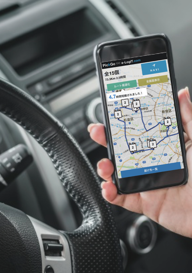
In developing these systems, we wanted to optimize the user experience of drivers. A key factor in our success is an intuitive Google Maps interface that makes using the app easy.
To run SmaRyu Post in conjunction with the existing PickGo system, we deploy a full range of Google Maps Platform APIs and SDKs in an integrated architecture. For app development, we rely on Maps SDK for Android to build mobile solutions that display dynamic maps in user-friendly fashion. Our apps then rely on Maps Javascript API as the core tool for loading and displaying various kinds of location information, such as landmarks and roads, within the app.
We deploy Directions API as the main service to calculate distances for optimal routing, while Geocoding API converts user addresses into precise coordinates. And an innovative use of Places API has proven crucial for last-mile delivery. With both Places API and Places SDK, we can easily establish the correct address by entering a building name and dropping a pin on the map. This combination unlocks the optimized user experience.

By deploying Google Maps Platform APIs such as Maps Javascript API, Directions API and Geocoding API, we have built a network of 55,000 registered drivers, with the average matching time between delivery request and driver at under one minute.
Our adoption of Google Maps Platform also led to the improvement of our team’s technology literacy. Many of our team use Google Maps, and want to learn more about how advanced mapping technology can change our world.
By helping us to invigorate the logistics sector, Google Maps Platform is enabling us to give a broader lift to Japan’s regions. In places facing depopulation, familiar shops are shutting one after the other. As transport services rapidly decrease, the difficulties in getting essentials such as food and household goods is becoming a big problem. We are offering solutions to resolve the logistics problems that Japan’s regions face, with systems that deploy Google Maps Platform.
For more information on Google Maps Platform, visit our website.
By: Taichirou Tokumori (Software Development Engineer, CBcloud)
Source: Google Cloud Blog